
Land Use Map
This is the current land use map for the City of Osawatomie. Please note that it does not include annexations that occurred after June 30, 2023.
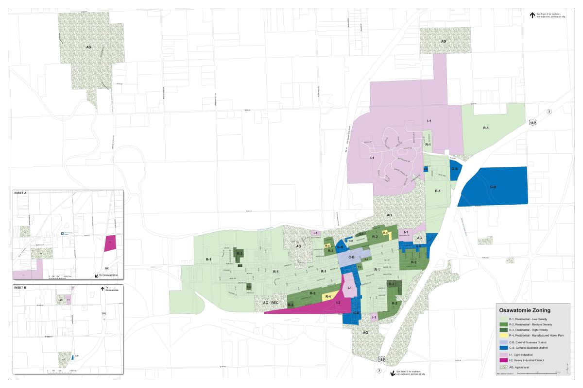
Part of the Comprehensive Plan 2040's activities will include envisioning what the community's FUTURE land use map will look like and how it will operate in the best interest of Osawatomie's future development.
As the community begins the next phase of Comp Plan 2040, City staff has engineered a DRAFT of the Future Land Use Map. To reiterate, THIS IS ONLY A DRAFT -- THIS IS NOT THE FINAL VERSION. City staff will be seeking public comment over the coming months in a variety of ways to help ensure all voices are heard in the process.
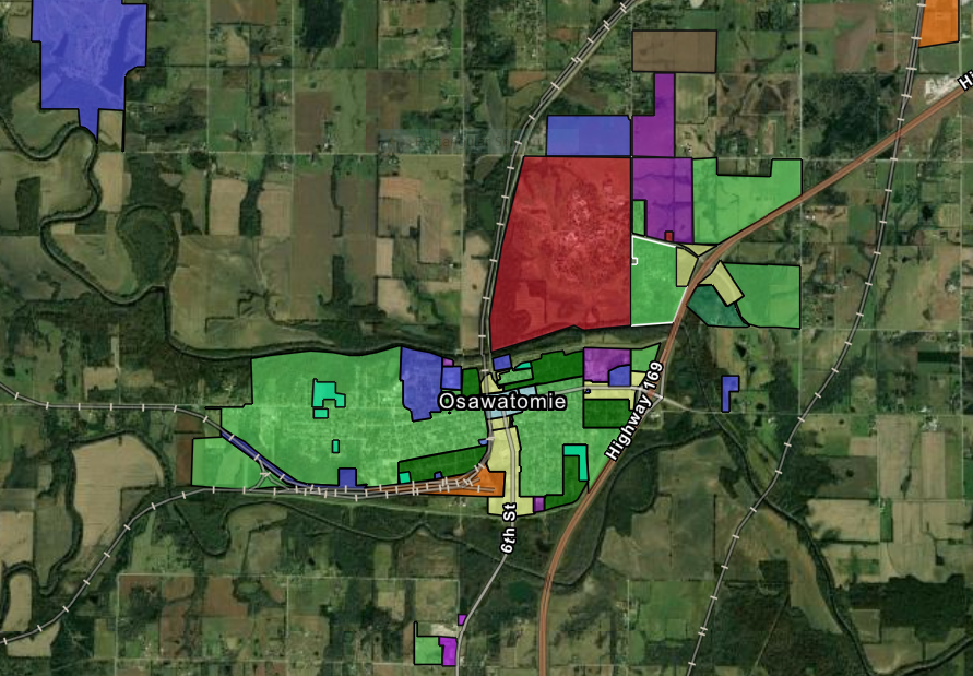
Click the image above to access an interactive version of the draft Future Land Use Map.
To use the interactive map:
- The "Layers" button at the bottom right allows you to turn off the various land use layers.
- The " +/- " buttons located at the top left to allow you to zoom in and out on the map.
- The best way to use this map is to turn the "Use Layers" OFF by clicking on each of them individually. Once the map is clear of colors you can then click each individual layer from the menu to bring it back on the map.
Please remember that the interactive map is simply a working draft of the future land use map. It is not a final version!
| Attachment | Size |
|---|---|
| 1.05 MB |